


Russian satellites jammed GPS signals across Europe 75 times since 2019. Each burst lasts under 10 seconds. The source is at least 1,200 km above Earth. And the pattern happens on Tuesdays, Wednesdays, and Thursdays during European business hours. That is not a coincidence.
Russia’s continental GPS jamming capability may be operational — and Western researchers have documented it in detail. A preprint paper published on 2 June by Professor Todd Humphreys and student Zach Clements at The University of Texas at Austin, together with Argyris Krizise at Stanford University, identifies a pattern of GPS interference affecting stations across Europe, Greenland, and Canada. The interference originates from space. The researchers traced it to Russia’s EKS Cosmos 2546 satellite — part of the Kupol/EKS early-warning constellation. Each jamming burst lasts under 10 seconds. Individually, each event is barely noticeable. Collectively, they describe a capability that could disrupt navigation, aviation, shipping, and military systems across an entire continent — simultaneously.
What’s Happening & Why It Matters
75 Events Since 2019 — and a Clear Weekly Pattern
Russia’s continental GPS jamming capability did not emerge suddenly. Humphreys and his team analysed ground station data covering January 2019 to April 2026 — using more than 165 reference stations across Europe, Greenland, and Canada. Across those seven years, they identified 75 days on which at least one widespread GNSS interference event affected the GPS L1 frequency band at 1575.42 MHz. That band is the primary frequency for US GPS, European Galileo, and China’s BeiDou signals. By contrast, Russia’s own GLONASS navigation system remained unaffected during every documented event. That selective targeting is not ambiguous. The interference degrades Western navigation systems while leaving Russian systems intact.

Additionally, the timing pattern carries its own significance. The interference events occur mostly on Tuesdays, Wednesdays, and Thursdays during European business hours. Humphreys told Veritasium directly: “I can no longer say this is accidental with confidence.” Scheduled operations — not technical malfunction — describe this pattern most accurately.
Why the Source Had to Come From Space
The geographical scale of the interference events defines the origin. Each jamming burst simultaneously affected GPS receivers across an area stretching from Iceland to Italy. Humphreys and his team calculated that producing interference at that simultaneous footprint requires the source to be at least 1,200 km (746 miles) above Earth’s surface. No ground-based jammer — regardless of power — can achieve that coverage geometry. The paper confirms this is “a rare example of human-made GPS interference coming from space.” Only two previous space-based interference incidents had entered the public record — both involving Chinese and American satellites with technical malfunctions, not systematic patterns.
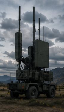
The EKS Constellation: Built for Missile Warning, Used for Jamming

The EKS Kupol system — of which Cosmos 2546 is a member — is Russia’s early-warning satellite constellation. Its official purpose is detecting ballistic missile launches through infrared sensors. By contrast, the constellation carries radio transmitters capable of operating on frequencies close to GPS L1. The interference signals reach 1577.5 MHz — close enough to GPS L1 at 1575.42 MHz to degrade navigation signals, but offset enough to maintain what researchers describe as “plausible deniability.” A direct signal would be unambiguous electronic warfare. An adjacent signal is technically deniable.
Humphreys describes the current activity as “practice rounds.” If Russia retuned the transmitters directly onto GPS L1 frequencies at higher power, continental-scale navigation denial is an immediate reality. In that scenario, aviation navigation, maritime routing, financial system timestamping, and military precision-guided systems across Europe would all degrade simultaneously. The May 2026 incident — in which Russia was suspected of jamming the aircraft carrying UK Defence Secretary John Healey —is in a more documented context.
The Military Implications
The Russia’s continental GPS jamming capability story carries direct military implications. NATO forces across Europe rely on GPS for precision targeting, logistics coordination, drone operations, and communications. European air traffic control uses GPS for separation assurance. Port and shipping infrastructure depends on GNSS timing signals for cargo coordination. Financial systems use GPS timing for transaction synchronisation. Each of those dependencies represents a system that a continental-scale GPS denial event could disrupt — even at the sub-10-second burst durations documented so far.
The US Air Force has received briefings on the Humphreys team’s findings — according to a source familiar with the matter. That confirms the findings reached military intelligence channels before the preprint’s public release. NATO has not issued a formal public statement on the research.
TF Summary: What’s Next

The preprint paper by Humphreys, Clements, and Krizise is available for public review. The findings were also presented at the ION GNSS+ conference in September 2025. NATO and individual European defence ministries are reviewing the research. No public Russian government response has been issued. The jamming pattern — based on 75 documented events since 2019 — shows no sign of stopping.
MY FORECAST: Russia’s continental GPS jamming capability will become the most discussed NATO electronic warfare concern of 2026 — and for the right reasons. Humphreys’ research transforms a pattern of anomalous signals into a documented, attributed, systematic capability test. NATO will issue formal guidance to member states on GPS resilience and backup navigation systems within 90 days of this paper’s wide publication. European aviation authorities will accelerate their eLoran and inertial navigation backup investment programmes. By contrast, Russia’s most significant advantage in this capability is not the jamming itself — it is the response lag it exploits. A continental GPS outage lasting even 10 minutes, at the right operational moment, creates military decision windows that Western planning currently does not account for. Humphreys has given NATO’s planners the data they need to close that gap.