

Waymo is no longer only trying to dodge potholes. Waymo is trying to rat them out to City Hall.
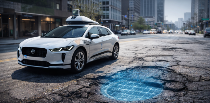
Robotaxis have been sold as a transport story for years. Safer rides. Fewer crashes. Less human error. Fine. The goal is getting weirder and, frankly, more practical. Waymo says its self-driving vehicles already spot potholes as they drive, and the company has launched a pilot with Waze to funnel road-condition data to cities and state transportation departments.
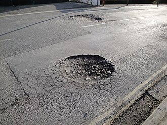
That sounds small until you remember how miserable potholes are. Potholes damage tires, bend wheels, rattle suspensions, annoy cyclists, and create a real safety risk to drivers and pedestrians. Cities usually rely on resident complaints, 311 reports, and manual inspections to find them. That system is slow, patchy, and wildly dependent on who bothers to complain. Waymo is arguing that a fleet of sensor-packed robotaxis can help fill the gap.
What’s Happening & Why This Matters
Turning Robotaxis Into Road Inspectors
Waymo has started a pilot program with Waze that shares pothole data through the Waze for Cities platform. The company says its vehicles already collect the right signals through cameras, lidar, radar, perception systems, and physical feedback from the car itself. In other words, Waymo has been feeling the road the whole time. The company has decided that municipalities may want the same information.
The pilot is launching across five initial markets: the San Francisco Bay Area, Los Angeles, Phoenix, Austin, and Atlanta. Waymo says the fleet has already identified about 500 potholes across those operating regions. Waze users in the same cities will be able to see those potholes in the app and confirm whether the reports are accurate, which then gives local governments a stronger view of actual road conditions.
Plenty of civic-tech pilots die because the data is clever on a slide deck but weak on the street. Waymo is trying to avoid that trap by pairing machine detection with human confirmation. A robotaxi flags the hazard. Drivers help verify it. Cities get a sharper map.
That is a smarter pitch than simple automation theater.
Cities’ Current Systems Are Patchy
Waymo says city officials have wanted access to this kind of information for years. That makes sense because the usual pothole-reporting system is not exactly elegant.
A city often learns about road damage only after someone is injured, complains about it, or spots it during an inspection loop. That means pothole response can depend on neighborhood reporting habits, staffing levels, seasonal weather, and whether public works teams are already stretched thin. A resident-driven system is better than nothing. A resident-driven system still leaves blind spots.
Waymo argues that its fleet can help fill those gaps. The company says its cars travel roads constantly, gather roadway information at scale, and can surface updates faster than cities usually can on their own. San Jose Mayor Matt Mahan said the city appreciates the collaboration as it explores how technology can help identify issues like potholes faster so officials can respond more efficiently. Sarah Kaufman, director of the New York University Rudin Center for Transportation, called the move an example of the “good neighbor principle in action.”
That praise is useful for Waymo because the company badly needs civic goodwill. Self-driving firms keep asking cities for trust, curb space, policy tolerance, and operational room. Offering data that helps make streets safer is not charity. It is a strategic charm with pothole detection attached.
Quietly Improving the Definition of a Robotaxi
This is where the story gets more interesting.
A robotaxi is no longer just a vehicle that gets passengers from one place to another. A robotaxi is a mobile sensor platform capable of collecting infrastructure intelligence at scale. Today, the target is potholes. Tomorrow, the target could be lane markings, curb damage, flooded streets, blocked routes, broken signals, or other roadway hazards.
That meaning carries weight because it changes the public justification for autonomous fleets. A robotaxi company can say, “We are not only operating on public streets. We are helping improve public streets.” That is a much friendlier political story than “please let us keep expanding while we displace drivers and jam downtown curb space.”
Waymo’s policy development and research manager Arielle Fleisher put it clearly when she said the company realized that once the fleet reached scale, it could share the data cities had asked for and that Waymo was already collecting. That sentence reveals the bigger play. Scale in autonomous driving does not only create transport coverage. Scale creates municipal data value.
That can help Waymo build influence with the same governments that keep arguing with robotaxi firms over safety, labor concerns, congestion, and regulatory access.
The Data Is Useful
The pothole idea sounds like an easy win. The politics under it are not so tidy.
The San Francisco Chronicle noted that some critics worry city budgets may shrink as robotaxis and other mobility shifts reduce parking and traffic revenue streams that traditionally help support transportation systems. Former San Francisco Municipal Transportation Agency director Jeffrey Tumlin argued that better pothole detection does not solve the deeper funding problem for street maintenance. Public Works officials have raised concerns about geographic equity too, since fleet-driven detection could overrepresent heavily traveled neighborhoods while underrepresenting less-served areas.
Waymo’s data is only as representative as Waymo’s coverage. If robotaxis drive affluent corridors heavily and lightly travel lower-income neighborhoods, then the pothole map may quietly inherit those same imbalances.
A city can fix that with additional reporting streams, but the issue is real. “Smart city” data often arrives with a hidden bias toward the places where sensors already spend the most time. That is not a fatal flaw. That is still a flaw.
So yes, Waymo’s pothole pilot sounds practical. It is not some neutral civic gift dropped from the heavens. It is a service that can help cities while helping Waymo deepen its municipal relevance.
Save Drivers Money. Save Cities Time
Even with the politics, the practical upside is obvious.
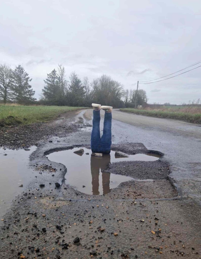
Potholes are expensive. They can damage suspension components, tires, wheels, and steering systems. They can cause sudden maneuvers that increase crash risk. They make cycling and micromobility more dangerous. A pothole that is unnoticed for weeks is not only an annoyance. It is deferred cost plus deferred safety.
Waymo’s blog says many cities still rely on non-emergency complaint systems and manual inspections to address potholes, which gives officials only an incomplete view of road health. A fleet already driving public streets can add a much denser reporting layer. Waze then extends the value by surfacing the hazard to road users and giving them a way to validate the location.
The beauty of the idea is not sophistication for its own sake. The beauty is that the sensors are already there. The cars are already driving. The roads are already being scanned because the robotaxi needs to understand the environment anyway. Waymo is basically trying to reuse an existing perception stack for public maintenance value.
That is the sort of secondary use case that makes expensive technology harder to dismiss.
Waymo May Be Best Positioned To Capture Street Data
Other companies use cars, mobile phones, cameras, and connected devices to collect mobility and roadway information. Traffic apps have leaned on user reports for years. Some cities mount cameras on municipal vehicles to detect street damage. There is no magic in the general idea of road sensing.
Waymo’s advantage lies in the depth and persistence of its sensor suite. A robotaxi sees constantly because it has to. Cameras, lidar, radar, onboard computing, physical feedback, and route frequency all make the vehicle a rich collector of street-level intelligence. That can give the company higher-quality data than a human driver casually tapping “pothole ahead” into an app.
That distinction may turn out to be decisive. A civic platform is only useful when the information is timely, credible, and frequent enough to support actual maintenance operations. A city does not need another dashboard that is mostly good in a meeting. A city needs road intelligence that public works crews can actually trust.
Waymo appears to understand that. The pilot is not being sold as a moonshot. It is pitched as a practical add-on to existing city workflows. That sales tone is clever because municipal officials are far more likely to adopt tools that fit the existing machine than tools that demand an entirely new machine.
Enabling Infrastructure Intelligence
The pothole story may sound quaint next to AI headlines about frontier models, billion-dollar data centers, or national-security drama. That would be a mistake.
A lot of the next phase of mobility technology will hinge on infrastructure intelligence. Which company sees the street best? Which company can convert perception into public value? Which company can help a city manage not only traffic but also the health of roads, curbs, hazards, and maintenance needs under everyday travel conditions?
Waymo is quietly arguing that autonomous fleets should be judged not only on whether they can drive safely, but on whether they are municipal sensing systems that improve the environment for everybody else. That argument may age well.
The public has heard enough robotaxi evangelism already. What cities want are practical benefits—fewer crashes. Better road insight. Faster maintenance. Less guesswork. If Waymo can help with those outcomes, the company gains something much more valuable than a flashy demo. The company gains political usefulness.
TF Summary: What’s Next
Waymo’s new pothole pilot with Waze shows how autonomous driving technology is starting to do more than carry passengers. The company says its robotaxis can identify road damage, feed the information into the Waze for Cities platform, help governments act faster, and even warn ordinary drivers through the Waze app. The initial rollout covers the Bay Area, Los Angeles, Phoenix, Austin, and Atlanta, where Waymo says the fleet has already identified around 500 potholes.
MY FORECAST: More robotaxi operators will try to sell themselves as infrastructure partners, not only transport providers. Potholes are probably the opening bid. The next wave will include lane damage, flood risk, blocked roads, curb issues, and street-condition mapping. The companies that win city trust will not only drive well. They will prove that their fleets can make public roads more manageable, more visible, and a little less broken.
— Text-to-Speech (TTS) provided by gspeech | TechFyle