


The removal of Starlink GPS location data is one of the most consequential changes SpaceX has made to its platform — and almost nobody in the consumer press noticed it. On 21 April 2026, Starlink sent an email to users notifying them that as of 20 May 2026, dish location will no longer be available via the local device gRPC API. That means the precise GPS coordinates — latitude, longitude, and altitude — that any device on a Starlink network could previously query in real time will disappear entirely from the local interface. The feature was obscure. Its removal is not.
What’s Happening & Why It Matters

What the gRPC API Feature Actually Did
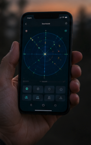
The Starlink GPS location removal specifically targets the gRPC API — a software framework running locally on each Starlink dish at the IP address 192.168.100.1. This is the same interface the Starlink app uses to communicate with the dish over Wi-Fi. It also exposes performance telemetry to third-party tools — signal quality, latency, obstruction maps, firmware versions, and GPS coordinates.
The GPS location endpoint was accessed through the app’s Debug Data section. A user had to enable location sharing there manually. Once enabled, any device on the same local network — including guest devices — could silently query the dish’s precise position. The level of accuracy was significant. Researchers at the University of Texas demonstrated in 2025 that Starlink signals alone could position a receiver to within 2 metres in 20 seconds using signals from an average of three satellites. That level of precision rivals dedicated GPS systems in many scenarios.
Who Actually Used This Feature
Most residential Starlink subscribers never knew the feature existed. They connected their dish, got internet, and moved on. By contrast, professional and industrial users depended on it heavily. Fleet managers operating Starlink dishes across trucks, ships, and aircraft used the GPS endpoint to track asset locations in real time. Home Assistant integrations for mobile Starlink setups relied on the coordinate data for automation triggers. Starlink resellers managing large numbers of customer dishes use it for network monitoring, troubleshooting, and service-level agreement enforcement.
At the same time, military operators in active conflict zones used the feature. Russian forces in Ukraine, who were using Starlink terminals — despite SpaceX‘s attempts to block them — could potentially expose their precise location through this endpoint to any device on the network. Conversely, Ukrainian forces and their intelligence partners could potentially exploit the same vulnerability to geolocate active enemy Starlink terminals. The endpoint was a security exposure in both directions.
Why SpaceX Made the Change — Four Possible Reasons
SpaceX provided no public explanation for the removal of the Starlink GPS location. That silence has generated substantial speculation. Developer and security researchers have offered four plausible motivations — and all four may be true simultaneously.

The first is military security. Starlink terminals are in active use across Ukraine, the Middle East, and other conflict zones. A dish that broadcasts its precise GPS coordinates to any device on the local network is a targetable asset. Removing that broadcast protects operators from inadvertent location disclosure — and removes a potential intelligence tool from adversaries on the same network. The second is corporate and enterprise privacy. Any device connected to a Starlink network — including guest devices, compromised IoT hardware, or malicious actors who gained network access — could silently harvest the dish’s exact location.
For enterprise and government clients, that exposure is unacceptable. The third is commercial positioning ahead of the IPO. SpaceX is preparing for an IPO targeting a $1.75 trillion valuation. Centralising control over Starlink’s positioning capabilities — rather than leaking them through an open local API — strengthens the company’s position as a potential competitor to GPS in the navigation market. The fourth is navigation commercialisation. If SpaceX eventually monetises positioning, navigation and timing (PNT) services from Starlink, it cannot do so while giving away equivalent precision for free through an unsecured local endpoint.
Starlink as a GPS Alternative: The Real Stake
The Starlink GPS location removal makes sense only in the context of a larger navigation battle underway. In May 2025, SpaceX acknowledged in a letter to the FCC that Starlink can provide positioning, navigation, and timing (PNT) services. That acknowledgement is the strategic statement. GPS — operated by the US Space Force — transmits from approximately 12,500 miles (20,200 kilometres) above Earth. Its signals are weak by the time they reach surface receivers. That weakness makes them vulnerable to jamming and spoofing.
By contrast, Starlink satellites orbit between 210 miles and 341 miles (340 and 550 kilometres) above Earth — roughly 40 to 60 times lower than GPS. Lower orbit means stronger signal strength. Stronger signals are harder to jam. The signal also travels a much shorter distance, meaning timing precision is higher. University of Texas researcher Todd Humphreys has extensively documented Starlink’s navigation potential. He found that with real-time clock and orbit corrections from SpaceX, Starlink could deliver position solutions with approximately 10-metre accuracy. A separate 2025 study by Zak Kassas and colleagues achieved 2-metre accuracy using just three satellites in 20 seconds. That is better than GPS under degraded conditions.
Ukraine, Jamming, and the Military Navigation Race
GPS jamming and spoofing have spread from conflict zones into civilian airspace across Europe, the Baltic region, and the Middle East. Airlines, maritime operators, and military aircraft all report increasing disruption. In the ongoing Ukraine conflict, GPS jamming is so pervasive that both sides routinely operate with degraded or denied navigation. Commercial aircraft crossing the Baltic and Black Sea regions have reported GPS signal loss. The aviation industry has identified this as a systemic safety risk, not an isolated technical problem.

At the same time, Russia‘s GLONASS, China‘s BeiDou, and the EU‘s Galileo all represent independent global navigation systems. The US Defense Advanced Research Projects Agency (DARPA) has funded alternative PNT programmes for years. Starlink’s potential as a backup or complement to GPS — operating from low Earth orbit with stronger signals — positions it as a genuine strategic asset in that environment. Removing open access to dish coordinates via an unsecured local API is the first step toward controlling that asset commercially and militarily. By locking down the endpoint, SpaceX removes the freeware version of a capability it may eventually sell to governments.
What Developers and Users Are Doing About It
The developer community reacted immediately to the announcement that Starlink would remove GPS location data. Several Starlink management tools — including Nexus Telemetry — began building workarounds before the 20 May cutoff. Their first update adds a manual location picker, allowing users to enter coordinates directly rather than relying on the API. Home Assistant integration developers are similarly pivoting. Third-party GPS receivers connected to the router can restore coordinate data for users who need it.
One developer noted an important technical detail. The GPS receiver inside the dish is still active. The dish still knows exactly where it is. The flag gpsValid: true still returns in the gRPC response, along with the satellite count. What SpaceX removed is not the GPS function — it is the API’s permission to share those coordinates externally. The data is locked behind authentication. The Starlink app retains access through protected endpoints. If SpaceX eventually creates an authenticated local API for third-party use, the function could return. As the same developer wrote: “Whether SpaceX eventually exposes an authenticated local API for third-party use is another question entirely, but the infrastructure for it exists.”
TF Summary: What’s Next

The Starlink GPS location removal takes effect on 20 May 2026. SpaceX began rolling it out on newer hardware — the V4 dish and Starlink Mini — and the location toggle no longer appears in the iOS app. Fleet managers, resellers, and developers relying on the endpoint have until that date to implement workarounds. Several have already deployed manual location alternatives. SpaceX offers a Telemetry API for enterprise customers, but it restricts location data to approximate grid cells rather than precise coordinates. That approximate data is not adequate for the use cases the gRPC endpoint previously served.
MY FORECAST: The Starlink GPS location removal is the first move in a long game. SpaceX is not simply removing a feature — it is reclaiming a capability for commercial deployment. Within 18 months of the IPO, expect SpaceX to announce a Starlink PNT service tier — a paid positioning, navigation, and timing product targeting government, military, maritime, and aviation customers who need GPS-grade or better precision from low-Earth orbit. The FCC’s acknowledgement of Starlink’s PNT capabilities was the legal groundwork. Removing the free local API endpoint is the product segmentation step. The paid PNT service is the commercial destination. Starlink’s low-orbit signal strength advantage over GPS makes that product genuinely compelling to defence customers in GPS-contested environments. This removal is not the end of Starlink’s GPS capability. It is the beginning of Starlink GPS as a business.